
Our Services
Engineering Surveying

Engineering Surveying is an important disciplinary field that serves construction projects. As experienced engineering surveyors, we have a proven record of providing accurate engineering surveys on the base of principles of surveying.
Purpose of Surveying: For use in design and construction of structural, infrastructure, transportation, environmental and civil engineering schemes.
Types of engineering survey:
- Topographical survey
(Includes Expressway/Highway/Railway/Metro’s/Gas pipe line/Water pipe line/H.T. line/Solar project) , - Route survey,
- Cadastral survey,
- Utility survey (GPR survey),
- Plan Profile L-section Cross Section survey,
- City detail Survey,
- Traversing survey,
- Levelling and Alignment Survey.
- GIS Mapping
Ground Penetrating Radar (GPR) Survey of Roads
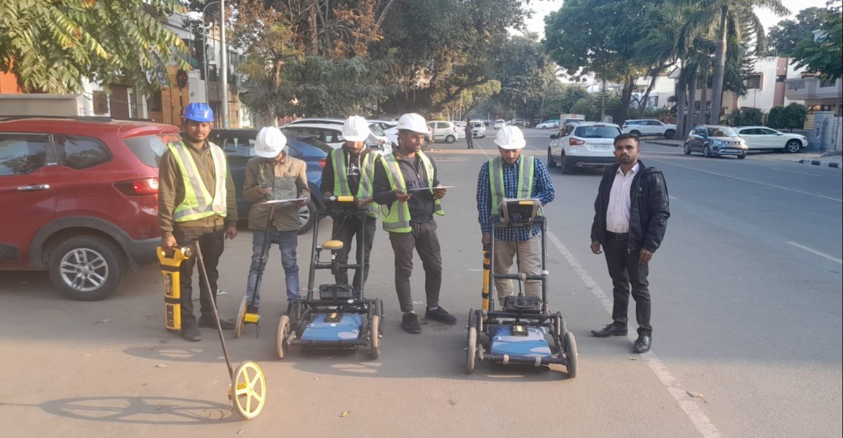
Ground-penetrating radar (GPR) is a geophysical method that uses radar pulses to image the subsurface. This non-destructive method uses electromagnetic radiation in the microwave band (UHF/VHF frequencies) of the radio spectrum, and detects the reflected signals from subsurface structures.
GPR uses high-frequency (usually polarized) radio waves, usually in the range 10 MHz to 2.6 GHz. A GPR transmitter emits electromagnetic energy into the ground. When the energy encounters a buried object or a boundary between materials having different permittivity, it may be reflected or refracted or scattered back to the surface. A receiving antenna can then record the variations in the return signal.
The electrical conductivity of the ground, the transmitted centre frequency, and the radiated power all may limit the effective depth range of GPR investigation. Increases in electrical conductivity lessen the introduced electromagnetic wave, and thus the penetration depth decreases. Because of frequency-dependent restriction mechanisms, higher frequencies do not penetrate as far as lower frequencies. However, higher frequencies may provide improved resolution.
Topographical Survey

Topographic surveys are typically a first step in any construction or development project, it may be necessary to perform a topographic land survey to identify various features and elevations of area land. J J Engineers has 7 years of experience in conducting topographic land surveys with remarkably accurate results.
What is a Topographical Survey?
A topographical survey, also known as a land survey or topographical land survey also known as contours. Topographical land survey measures and identifies the exact location and specifications of natural and human made features within an area of land. The survey is then drawn up into an appropriate and detailed plan it includes human-made features such as boundaries, neighbouring buildings, walkways etc. The topographical survey also picks up natural features such as trees, ponds and ground contours.
Top 5 Benefits Topographical Survey?
- Having a detailed and accurate picture of your land can reduce the risk of costly downstream mistakes caused by unforeseen issues.
- In the case of purchased land, a topographical survey can reveal any information that might be hidden from plain sight, including the changes that have occurred on the area over a period of
- It can provide the necessary data you will need about the land before making any changes to it.
- It provide engineers and architects with the necessary information to create correct and suitable designs for the property’s unique features.
- It provide final as-built data to verify that the site was built in substantial conformance with proposed plans.
Drone Survey

Drone surveying is an aerial survey conducted using drones and special cameras to capture aerial data with downward-facing sensors. It is frequently used by surveyors and engineers in construction for terrain assessments and mapping. Drone surveying can be 90% faster than manual surveying methods. It helps in creating highly accurate maps and survey points. In addition to surveying, firms also use drone mapping to identify job-site errors, track work progress, predict schedule delays, etc.
For more than 5 years we have been providing drone photogrammetry survey to enable easy 3D topographic drawings. Our customers are in various industries, including Government Agencies, Consulting Engineers, Surveyor, Infrastructure, Construction companies, Architecture, Archaeology, developers and many more.
RTK/PPK Drone survey to create accurate maps for the measurement of point-to-point distances. Not only can you get accurate results, but in most cases using the PPK/RTK drone to survey will reduce costs associated with traditional methods, including that spent on labor, hardware, and software. This also comes with the general benefits our customers achieve, such as greater productivity, faster time to insights, improved collaboration, and increased job site safety.
However, we use of some ground control checkpoints, few GCPs is still established to ensure accuracy and provide accountability for the output. PPK Drone surveys are similar to RTK Drone surveys, but the positions are corrected in GNSS PPK Path Processing. It usually involves placing a static base station over a known control point, or a monument to allow for geolocation. GPS data is then simultaneously collected by the base station and the drone as it flies. That data is then downloaded from the base station, and the rover (drone), and post processed using a GPS software. These images can then be processed and generated various output.
Traffic Survey
A traffic video survey provides a highly accurate record of traffic or pedestrian activity taking place in a specified area. It is often used to measure volume of traffic, junction, pedestrian movements or queue lengths, for example recording classified priority junction counts or roundabout surveys using dual cameras.
Origin Destination Survey (OD)
This survey identifies the travel pattern of vehicles along a road network. This survey spots where most vehicles originate in a network and finish their journey and it also shows how often they take this path. We use advanced technologies including ANPR, Bluetooth and expert manual methods. This can also be done using Roadside Interviews depending upon the location and feasibility. OD surveys of people can also be collected manually by interviewing them.
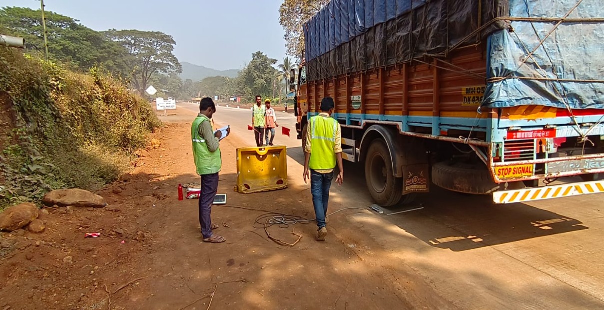
Axle load survey
An axle load survey is carried out to determine the axle load distribution of the heavy vehicles using the road. These survey data are then used to calculate the mean number of equivalent standard axles for a typical vehicle in each vehicle class.
Axle load survey is needed to generate data for pavement design. Portable weigh bridges are very useful for this purpose. This survey shall be carried out along with classified volume count survey. Number of days of survey will depend on project location, the type of project and the intensity and expected variation in traffic
Geotechnical Investigation
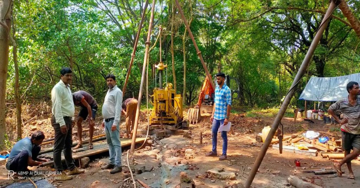
Soil drilling and rock coring for sub-surface investigation including in-situ soil testing and sample recovery and mining drilling.
Our drilling expertise includes the following:
- Soil drilling with sample recovery utilizing undisturbed sampling techniques. Typical borehole sizes are 75 mm, 100 mm, 125 mm and 150 mm diameter
- Rock coring with samples recovered by diamond coring of Nx size i.e. 76 mm diameter
- Drilling for Open and Underground Mining of Ax, Bx, Nx, Hx, Px size
- Standard Penetration Test
- Field Density tests
- Dynamic Cone Penetration Test
- Pressure meter Test (100 Bar Manard make and 200 Bar OYO make)
- Block Vibration Test
- Field Vane Shear Test (VST)
- In-situ Permeability Test
- Packer Permeability Test
- Plate Load and Pile Load Tests
- California Bearing Ratio test
- Trail Pits